Overview
The EMIT mission will image the mineral content of dust producing regions of the Earth. As part of this effort, it will collect unprecedented coverage of visible to shortwave infrared (VSWIR) radiance and reflectance data and use them to produce estimates of the fraction of the surface covered by green vegetation, non-photosynthesizing vegetation, and ten important minerals over arid regions of the planet. These data products, hosted on the LP DAAC, will allow for investigations beyond the EMIT mission science objectives which will inform decision makers across a wide range of potential application areas for the benefit of society. NASA’s Applied Sciences Program, the EMIT project team, and collaborators are working together to further the applications potential of these groundbreaking data. We are committed to NASA’s Open Source Science Initiative and will be providing research grade data products to the public, in addition to its science deliverables, as they become available.
Active Applications Areas
Greenhouse gas mapping
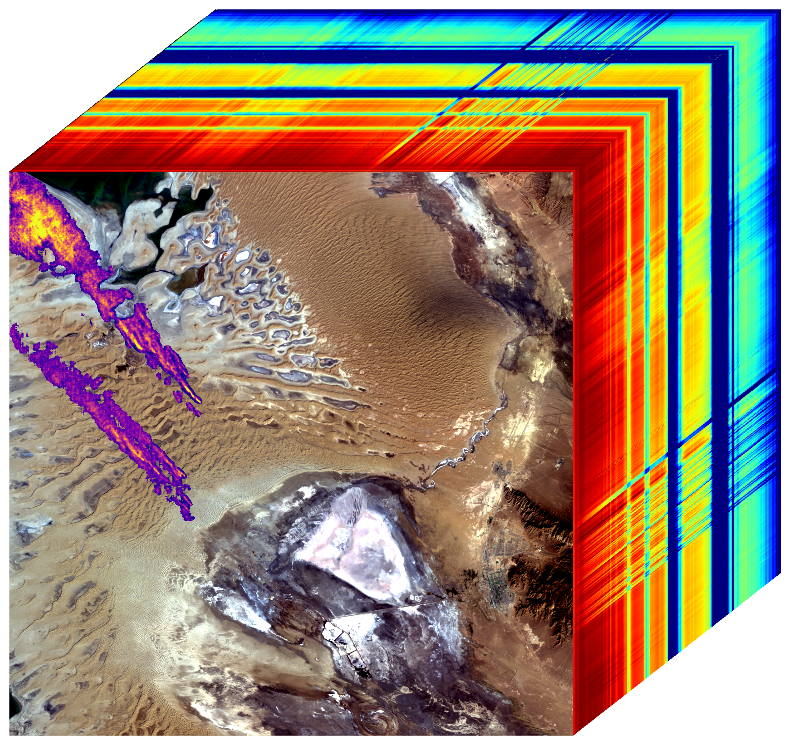
Carbon dioxide and methane are the two dominant gasses that contribute to climate change. Methane traps more heat in the atmosphere per molecule than carbon dioxide, therefore targeting reductions in anthropogenic methane emissions offers an effective approach to decrease overall atmospheric warming. Methane and carbon dioxide have distinct absorption features in the shortwave infrared (1800-2500nm) that permit the detection and mapping of point source greenhouse gas emissions with EMIT data. Identifying strong emission sources offers the potential to improve our understanding of anthropogenic emissions and to mitigate those emissions. For example, oil & gas operators can locate and fix leaks that are both expensive and environmentally damaging, providing a win-win opportunity. Other sectors could use this information to identify opportunities for methane capture for either flaring or conversion to fuel resources.
EMIT will be sharing research grade methane and CO2 emissions detections as we locate them, in keeping with our open science and open data policy. These results will enable user groups and the public to access the information quickly and utilize the data as they see fit.
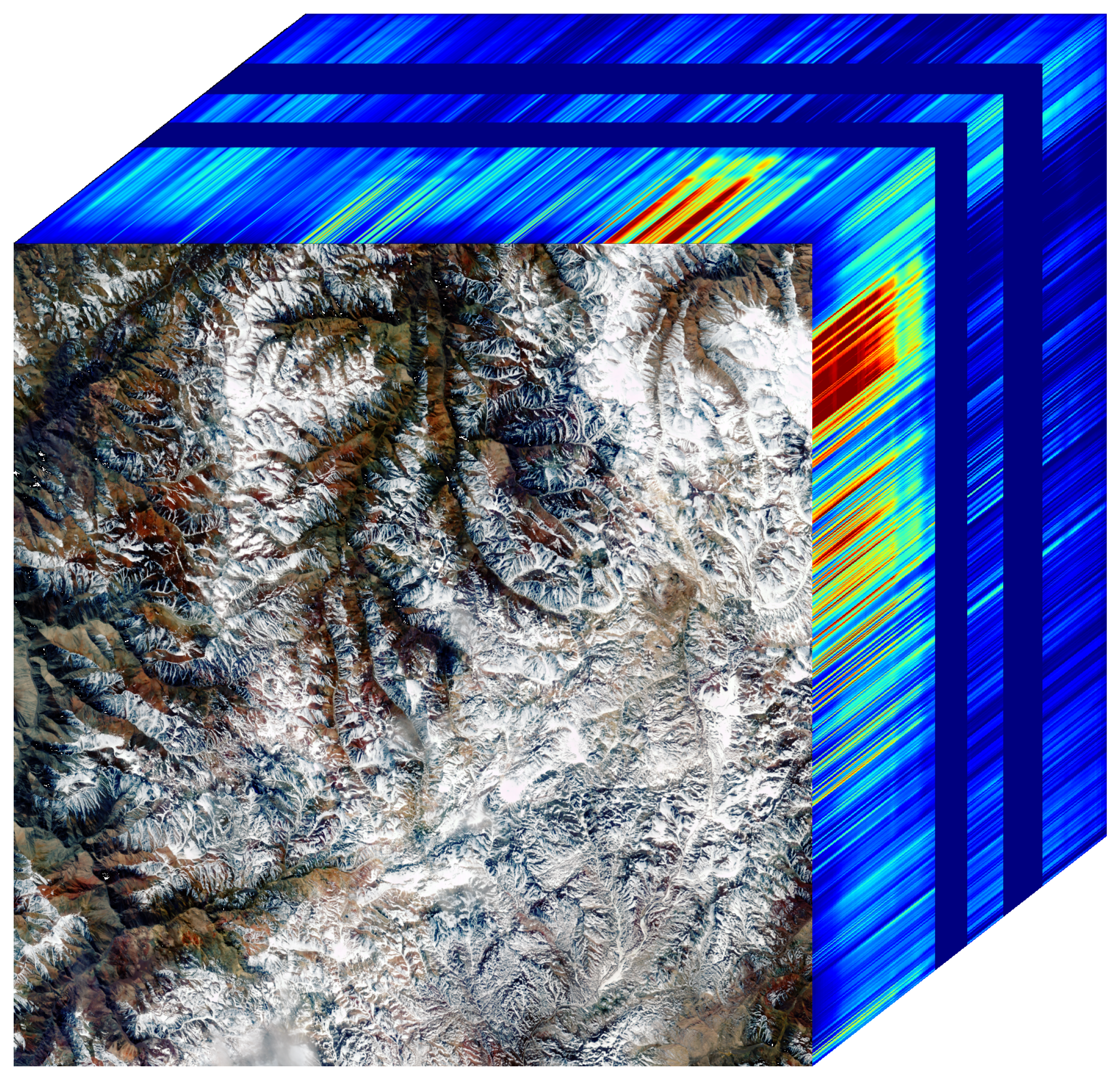
Snow properties and water resources