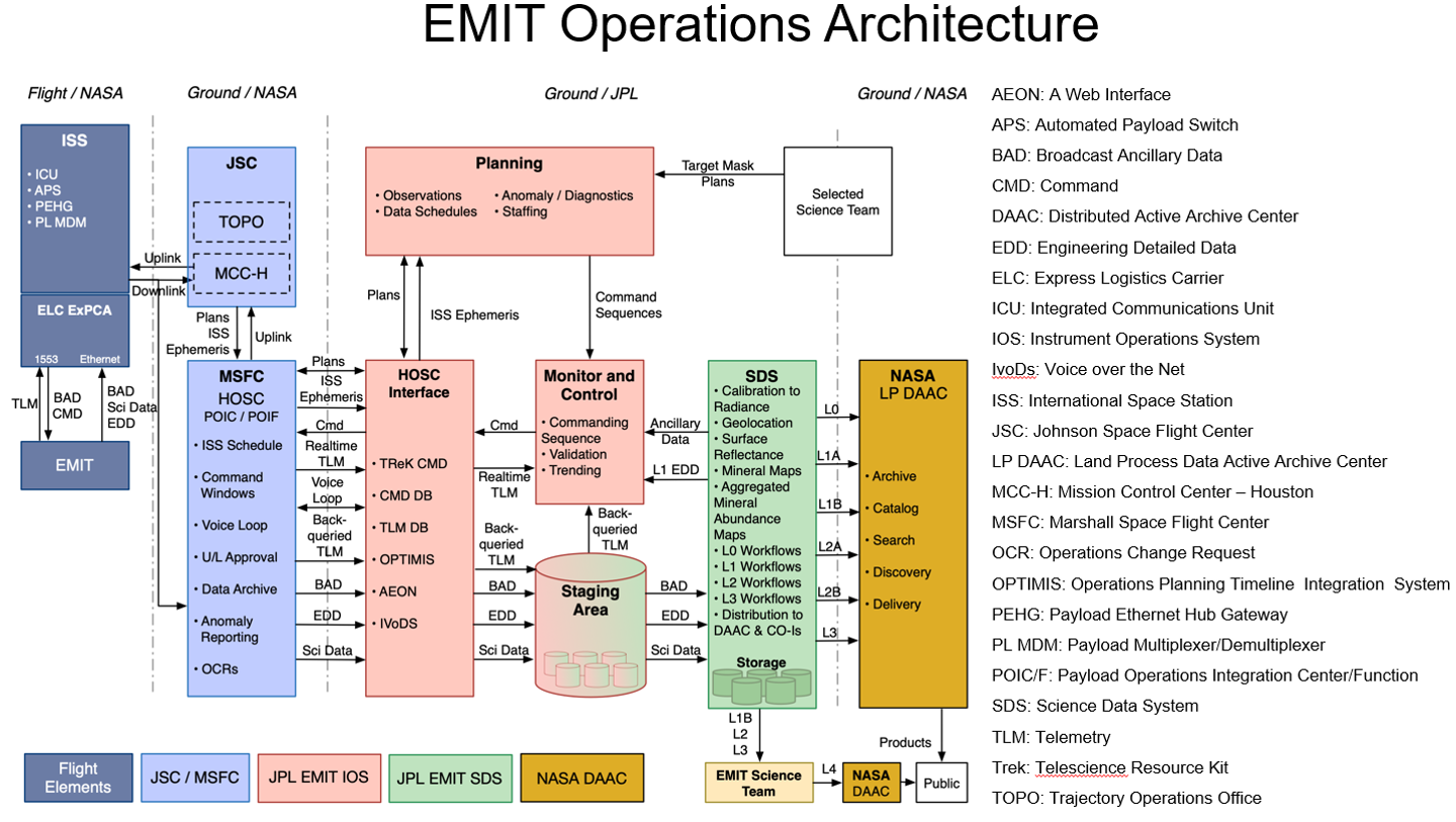
EMIT requires a sophisticated operations architecture to function successfully on the ISS and collect the measurements of the Earth’s arid land mineral dust source regions to achieve the science objectives. L0-Downlinked Data, L1-Calibrated Data, L2-Mineral Data, L3-Data for Earth System Models.
EMIT Target Arid Land Dust Source Regions
The EMIT science team has developed and refined the target area for the current and potential future arid land dust source regions. EMIT operations are focused on collecting data from these areas from the instrument's perch on the ISS. EMIT has the capacity for multiple acquisitions over these areas to account for possible cloud interference or poor observation conditions.
EMIT Measurement Approach From the ISS
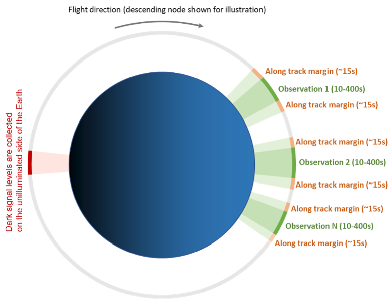
The Operations team will send commands to EMIT to measure portions of the Earth below the ISS that are EMIT targets. These dust source targets will be measured under conditions of good illumination by the sun. To process the EMIT measured signals the dark signal levels are captured by EMIT on the unilluminated side of the Earth. Dark signal levels are the values gathered by the instrument when no signal is arriving at the telescope.
Planned Build Up of EMIT Coverage as ISS Passes Over Illuminated Dust Source Regions
EMIT coverage is built up from along-track orbit acquisitions when the illumination conditions are appropriate over the EMIT target areas.
Planned Complete EMIT Coverage
When complete, the EMIT imaging spectroscopy measurements will be acquired over the full target area. EMIT will collect extra measurements around the periphery to assure full coverage. EMIT will collect multiple acquisitions over the target areas to allow for periodic cloud obscuration. All of these measurements will be processed through the EMIT science data system to deliver mineral composition maps for the initialization of the Earth System Model to achieve the EMIT science objectives. EMIT measurements and products will be archived at the NASA Land Processes (LP) Distributed Active Archive Center (DAAC) for use by the full science and applications community.