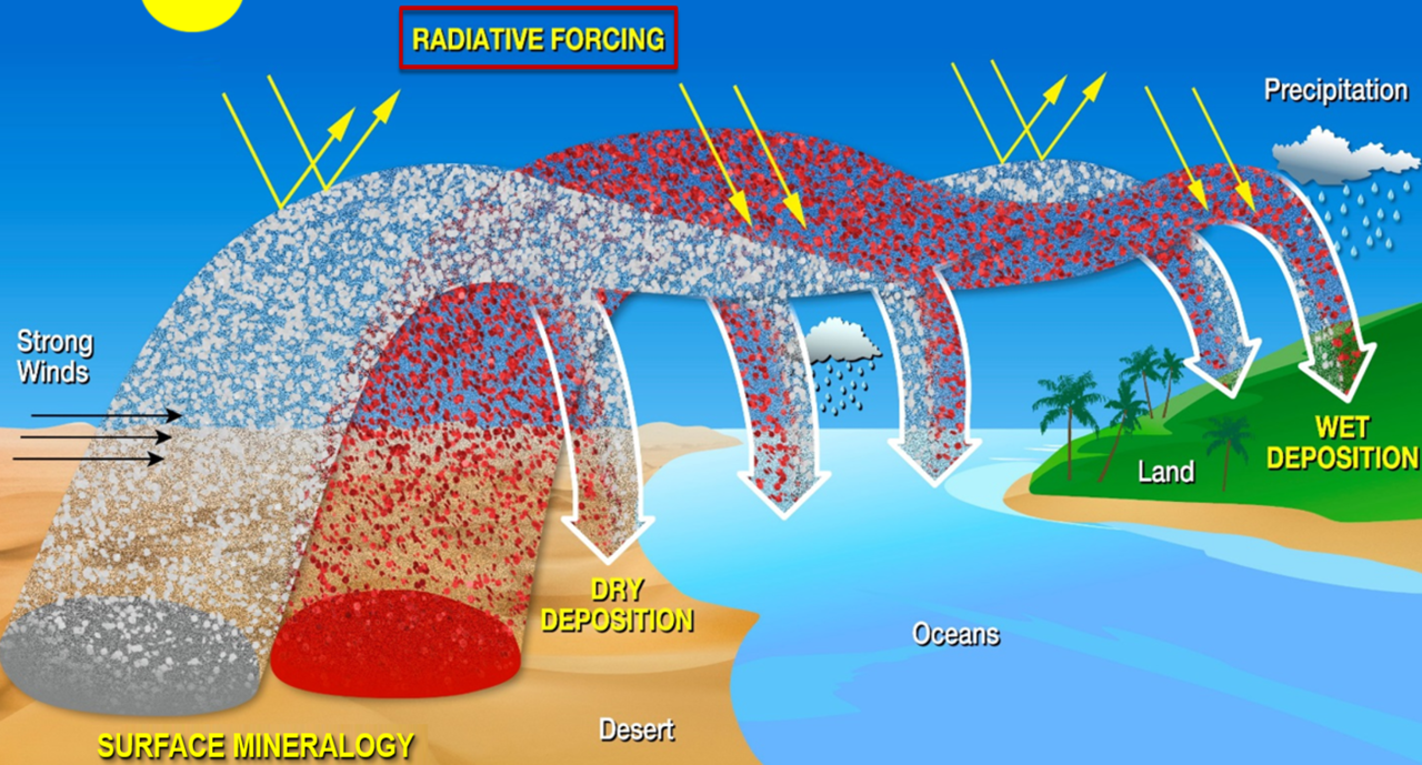
Strong winds lift mineral dust from Earth’s desert and dryland regions and carry the dust particles great distances. Depending on its color and composition, mineral dust can affect Earth’s environment in different ways. Dark particles absorb sunlight and heat our planet, while light-colored particles can have a cooling effect.
Minerals containing iron tend to be dark, and those with clay tend to be lighter in color. To improve global science models and understand how dust heats and cools the Earth’s environment, scientists need to know the dust’s mineral composition as it blows around Earth.
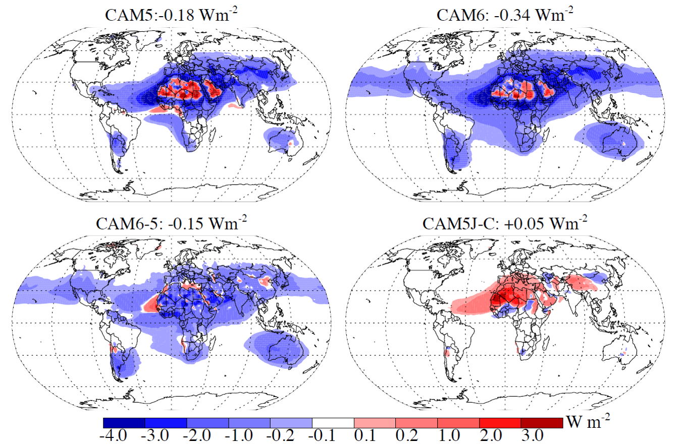
For the first time, the NASA Earth Surface Mineral Dust Source Investigation (EMIT) mission will comprehensively measure the mineral composition of Earth’s dust source regions to help scientists understand how they heat or cool our planet. EMIT’s science objectives are specifically focused on better understanding this heating and cooling effect, which is called radiative forcing. The first objective is to deliver a new improved assessment of the heating and cooling effects of mineral dust in the Earth’s atmosphere. The second objective is to predict how future climate scenarios might change the amount and type of mineral dust emitted into the Earth’s atmosphere.
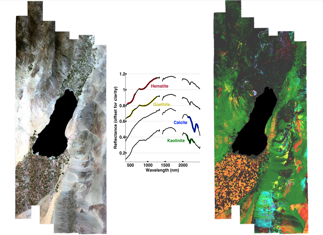
To achieve these objectives, EMIT will use imaging spectroscopy, an advanced technology invented by NASA, and widely used in the agency’s space missions. For each location in an image, EMIT will measure the spectrum of light — ranging from visible into the infrared — reflecting from Earth’s surface. The measurements will reveal distinct spectral signatures (or ‘fingerprints’) of the minerals in dust source regions. Scientists will then use those observations to generate new, more accurate mineral composition maps of Earth’s dust source regions.
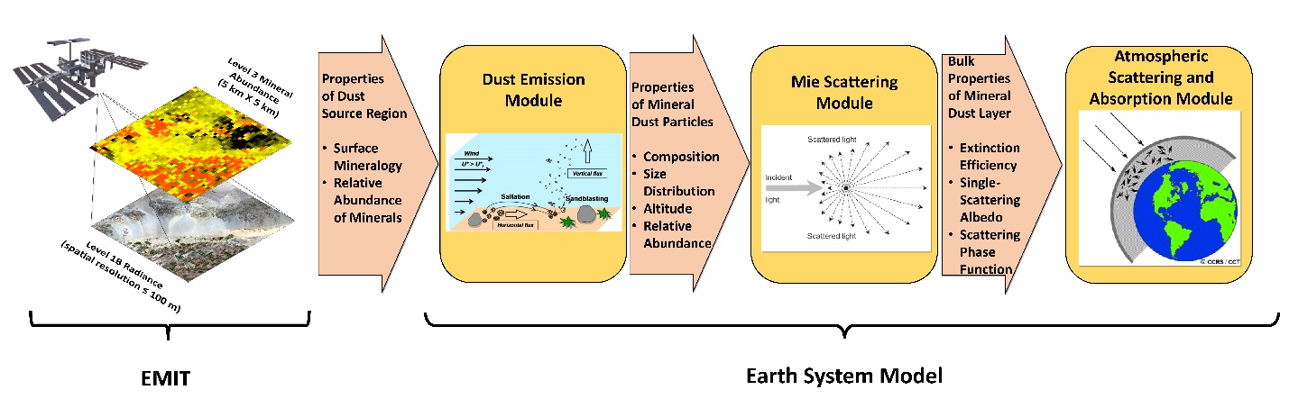
EMIT is a NASA Earth Venture Instrument investigation focused on achieving its two objectives. But the mission is also committed to ensuring that its measurements are made available for the additional science and applications that they will enable. All EMIT measurements and data products will be made available publicly through the NASA Land Processes Distributed Active Archive Center.
The EMIT instrument builds upon NASA’s long history of developing advanced imaging spectrometers for new science and applications. EMIT launched to the International Space Station (ISS) on July 14, 2022.