Overview
Increased melting of snow and ice makes Earth more absorptive of sunlight and moves enormous volumes of stored water from land surfaces, raising sea level and changing water availability to large populations. With increased solar absorption, melt commence markedly earlier in the snow season. EMIT’s spectral and spatial coverage helps us to improve our understanding of the low- to mid-latitude distribution of controls on the snow surface brightness (albedo), and supports a more accurate modeling of cryosphere processes in snow-covered mountainous regions.
EarthData Sub-Topic Tags: snow albedo, snowmelt, freshwater supply, flood prediction, watershed management
Snowmelt Prediction
MeltMetrics - Modernizing Regional-to-Global-Scale Snowpack Dynamics Monitoring, focusing on Snowmelt Prediction Accuracy using advanced EMIT Spaceborne Imaging Spectroscopy and Assimilation with Hydrological Modeling
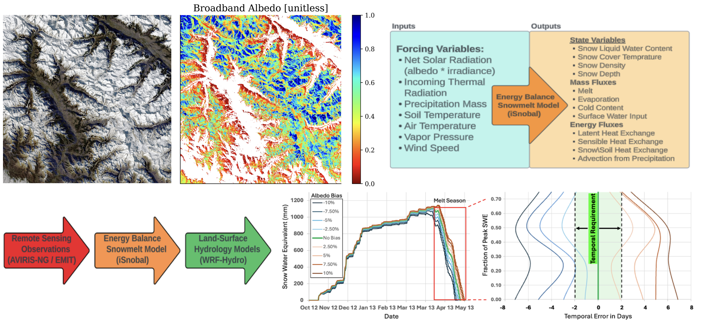
Estimating meltwater flow in snow-dominant watersheds is crucial for water managers, supporting timely decisions regarding water allocation and flood prevention. The most critical information for water managers is the exact date of peak water flow through the watershed, which they require with an accuracy of 24-48 hours. Snow albedo is one of the most essential factors in snowmelt modeling, significantly influencing radiative forcing and snowpack thermodynamics. EMIT’s high spectral sampling provides accurate data to estimate snow albedo, offering the potential to improve meltwater flow forecasts in critical watershed districts.
Other team members not pictured: Carrie Vuyovich (NASA GSFC), Ned Bair (Leidos, Inc.), Jo Meyer (Boise State), Tom Painter (ASO), Matt Meadows (KRWA)