Air Surface Water and Ocean Topography is the calibration/validation and science support instrument for the NASA/CNES/CSA SWOT mission.
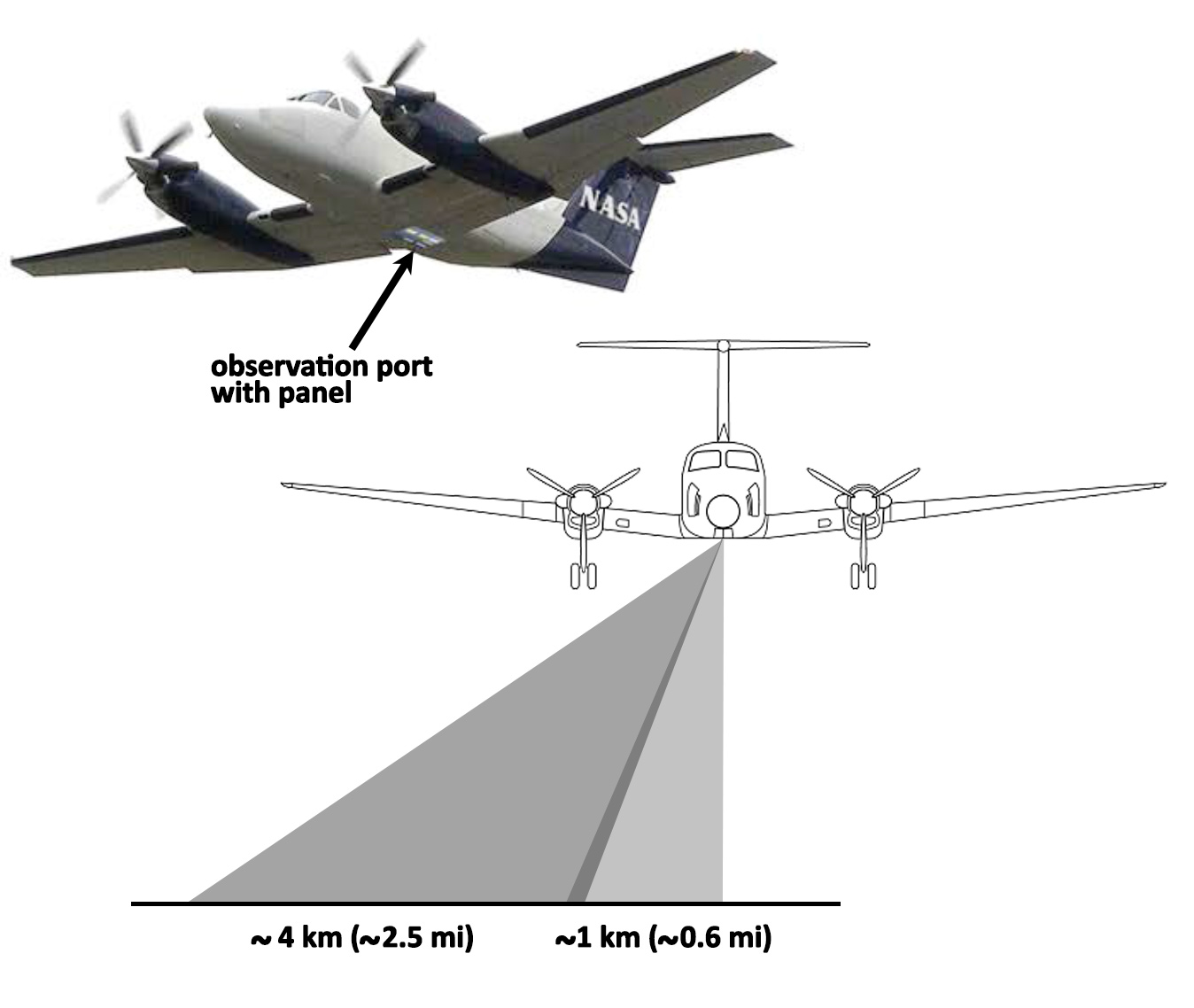
The core of AirSWOT is a multi-purpose Ka-band radar, KaSPAR. This instrument collects two swaths of across-track interferometry data (nominally, between nadir and 1 km and between 1km and 5 km, respectively) which can be used to obtain centimeter-level topographic maps of water surfaces and flood plains. In addition, KaSPAR implements an along-track interferometer that can be used to measure the temporal decorrelation of water surfaces, as well as the water radial velocity. Finally, the radar measurements can also be used as a nadir-looking synthetic aperture radar altimeter.
In addition to the KaSPAR measurements, AirSWOT will provide complimentary measurements using facility instruments from NASA's Airborne Science Program, including:
Digital Camera System: For validation of surface water extent and for characterization of terrain type, simultaneous measurements will be collected using NASA Digital Camera System.
Precision IMU: Precision attitude and positioning information will be collected using NASA's Airborne Science Program facility Inertial Motion Units consisting of an Applanix POS LV system.
Instrument specifics
- Status: ACTIVE
- Type: Ka-band radar
- Products: Centimeter-level topographic maps of water surfaces and flood plains
- Two swaths of across-track interferometry data
Platform(s)
- B-200 King Air
Campaigns flown
- SWOT Cal/Val
- Delta-X
- ABoVE
Contact