The Uninhabited Aerial Vehicle Synthetic Aperture Radar (UAVSAR) is a reconfigurable, polarimetric L-band synthetic aperture radar (SAR), specifically designed to acquire airborne repeat track SAR data for differential interferometric measurements. Differential interferometry can provide key deformation measurements, and is important for studies of earthquakes, volcanoes and other dynamically changing phenomena.
Using precision real-time GPS and a sensor controlled flight management system, the system can fly predefined paths with great precision (to be within a 10 m diameter tube about the desired flight track).
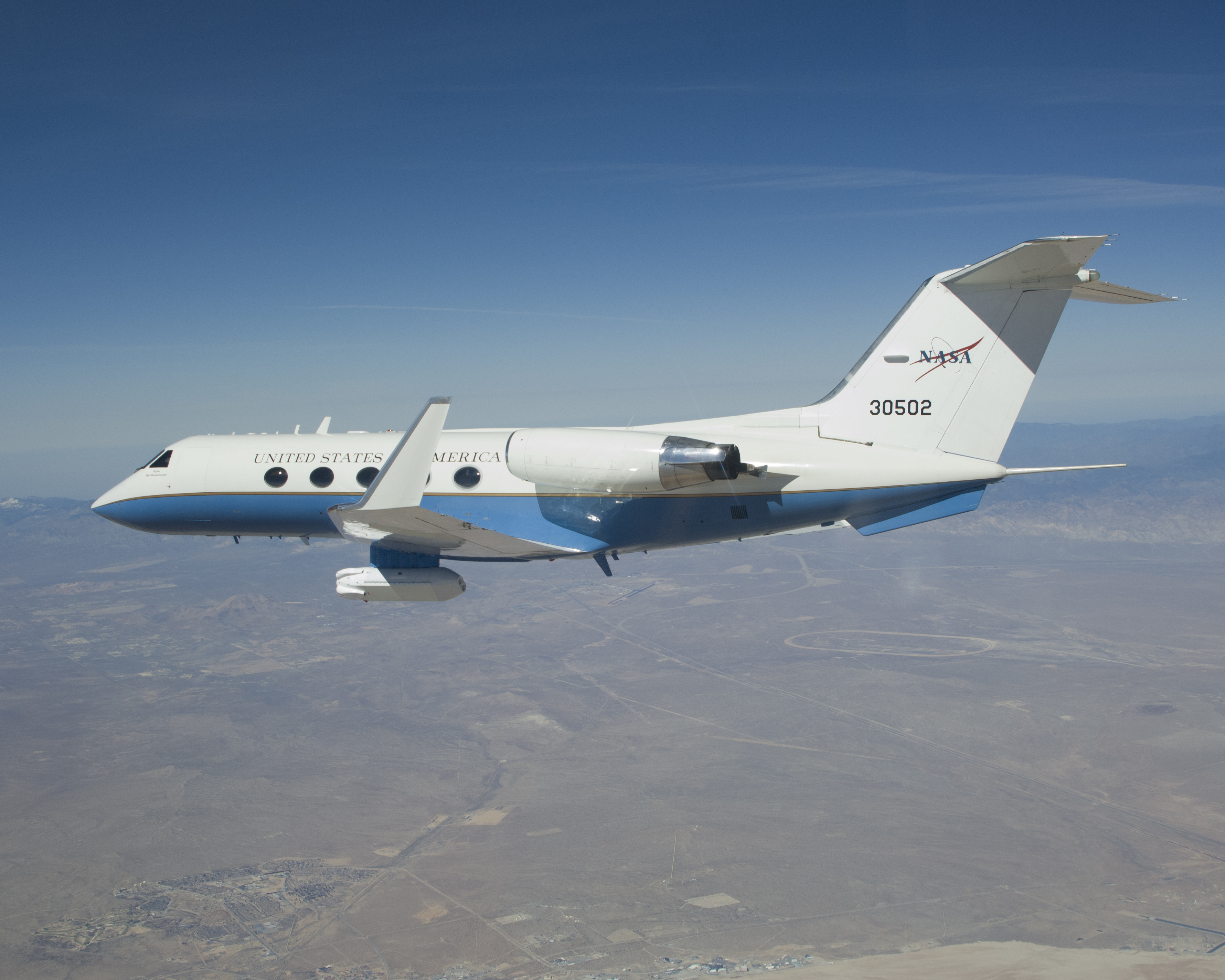
The radar was designed to be operable on a UAV (Uninhabited Aerial Vehicle), but is currently flown on a NASA Gulfstream III. The radar is fully polarimetric, with a range bandwidth of 80 MHz (2 m range resolution), and a range swath greater than 16 km.
The antenna may be electronically steered along track to assure that the antenna beam can be directed independently, regardless of speed and wind direction. Other features supported by the antenna include elevation monopulse and pulse-to-pulse re-steering capabilities that will enable some novel modes of operation. The system will nominally operate at 41,000 ft (13800 m).
In addition to the initla L-band, UAVSAR is now configurable for P-band and Ka-band. The long wavelength P-band radar (aka AIRMOSS) is designed for subsurface and sub-canopy imaging applications such as monitoring root zone soil moisture, forest and permafrost changes, and detecting underground structures and subsurface changes. UAVSAR-Ka (aka GLISTIN-A) is a state-of-the-art Ka-band airborne single-pass interferometric SAR designed to map land surface topography.
UAVSAR began as an Instrument Incubator Project (IIP) funded by NASA Earth Science Technology Office (ESTO). It has been operational since 2009.
Instrument specifics
- Status: ACTIVE
- Type: L-band, P-band, Ka-band actively electronically scanned antenna
Platform(s)
- G-III
Campaigns flown
- ABoVE
- AfriSAR
- FireSense
- SMAPVEX
- Delta-X
- NASA ISRO ASAR
- SnowEx
- OMG
- AIRMOSS
- hurricane, oil slick, and flood mapping
- Deployments to CONUS, Hawaii, Alaska, Greenland, Central & South America, Japan, Costa Rica, and Europe
Contact
Get Data
In the News
Links
Keywords
topography, wildfire, volcano, permafrost, glacier, disaster response