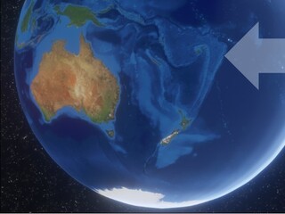
In April 2020, a major tropical storm formed in the south Pacific. The timing was ironic: it was almost the end of the cyclone season and there were hopes that the worst was over.
Instead, Cyclone Harold sailed its way as a category 5 tempest across four isolated island nations, including Fiji. It was the most ferocious storm of the season. Winds reached up to 165 miles per hour. The COVID lockdowns had just started and made everything more complicated. For smaller islands, rescue workers could get no information on how many people’s homes had been destroyed, and who needed food aid. Communications towers were knocked out and some islands just went completely dark.
Here in Pasadena, over 5000 miles and 20 time zones away, Sang-Ho Yun was watching the storm as well. It’s Sang-Ho’s job, along with his team at JPL, to provide help when disasters like Cyclone Harold strike. It didn’t matter that lockdowns were in effect. It didn’t matter that the storm was nowhere near California. With sunshine streaming through his living room windows, Sang-Ho tapped away at his laptop, monitored the storm, and kept an eye on a team of special satellites orbiting Earth tasked with helping during disasters.
Sang-Ho and his team make up the ARIA project (Advanced Rapid Imaging and Analysis). And just like an aria in an opera relies on all the musical instruments and the singer harmonizing together, it's the same with JPL’s ARIA: it’s an orchestration of satellites from all over the world, launched by many nations. All these spaceborne “eyes” on Earth pool together their information to help people struck by hurricanes, floods, fires, explosions, and many other disasters. And while a vulnerable island might suffer a blackout, not even the most powerful storm can knock these satellites out, or obstruct their role in monitoring what’s happening on Earth’s surface.
All Sang-Ho and his team needed was to wait for one of these satellites to pass over the stricken area. On April 10, two days after Cyclone Harold pummeled the last of the islands and went grumbling off into ocean oblivion, the wait ended. Sentinel-1, a satellite constellation operated by the European Space Agency, reached the spot. But it’s not a competition; other times, satellites from Japan, Italy, or Canada have reached the site of disaster first. The United States and India are soon to launch another satellite, NISAR, that will also assist in this work.
-
NISAR
NISAR, a radar satellite in development, is a collaboration between NASA/JPL and the Indian Space Research Organisation. Learn more about NISAR's progress here.
-
Sentinel-1A constellation of twin satellites operated by the European Space Agency, Sentinel-1 allowed Sang-Ho and his team to create maps approximating the damage from Cyclone Harold on the isolated islands. Credit: ESA
Sang-Ho and his team accessed the data from Sentinel-1 rapidly. By the very next day, they had processed the data through the special algorithms they have developed and dispatched the maps to emergency response workers.
Rohini Sampoornam Swaminathan was one of these workers. Employed at the United Nations World Food Programme (WFP), her role was to study satellite information to find locations most in need of emergency aid. Rohini’s childhood inspired her line of work. She grew up in southern India, and saw the destruction first-hand of the Christmas Day tsunami that killed over 200,000 people along the coasts of the Indian Ocean. She decided to make a career out of helping people survive disasters. She found, though, that it could be easier said than done.
One of the first disasters Rohini worked on was a 2015 earthquake in Nepal that killed almost 9000 people. She remembers that terabytes of satellite data were delivered to her and other emergency workers, all from agencies eager to help. But not all images were useful – most showed nothing but clouds.
It turns out that all those cloud-obscured images were captured by optical satellites. Optical satellites can provide beautiful details of Earth, such as mountain ridges, rivers, even city streets – but only if the skies are clear.
The ARIA project and Sang-Ho, on the other hand, rely on a completely different type of satellite – a radar satellite. Radar can pass through clouds unobstructed. Not just that, but when Sang-Ho compares two radar images of the exact same location – before and after a disaster – he can find places where the surface of Earth has shifted or where a building has collapsed. As the radar signal hits Earth and bounces off the surface, it does so differently depending on whether it encounters an intact building or a pile of rubble.
Of course, there’s also a lot the satellite doesn’t know. For example, the disruptions a radar satellite detects could be merely the collapse of an old, abandoned shed; on the other hand, it could represent a cherished home with a now homeless family. Only closer surveillance, perhaps through helicopter or on-the-ground visits, can tell the difference. But the ARIA maps at least let emergency responders know where to start looking.
This was particularly the case for Cyclone Harold. COVID lockdowns, in combination with digital blackouts, contrived to stymie the aid operations. The most isolated islands remained off-the-grid and inaccessible over a week afterward. Local governments were scrambling. Luckily, when they turned to the World Food Programme for help, Rohini and her colleagues could at least hand over JPL’s ARIA maps. As Anare Motokula of the WFP Country Office said, the ARIA maps were awesome. "They helped us see and understand the number of destroyed buildings, and the local governments were really happy to receive them.” It quickened their response and helped provide an estimate of the total number of people needing aid, in the absence of any other information.
It only happened through many puzzle pieces, scattered worldwide, coming together. That’s part of the beauty of ARIA, says Sang-Ho: the manifold space agencies that gather the data, the ungrudging impulse to share that data freely, the lines of communication and partnership built over the years. Together, they extract the fruits of space science to provide whatever support they can to emergency responders, who in turn, are trying to save the lives of the most vulnerable people on the ground.


