Earth Science Stories | June 23, 2022
Career profile: Talib Oliver Cabrera on his early career at JPL

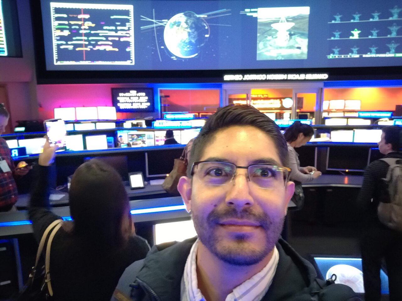
Talib Oliver Cabrera takes a selfie on his first day at JPL.
In just two years at NASA’s Jet Propulsion Laboratory (JPL), Talib Oliver Cabrera’s career has included a pandemic, dolphins, and a near-miss with a hurricane.
His first assignments at JPL have focused on the fragile wetlands on Louisiana’s coast, as part of JPL’s Delta-X mission. This is a unique mission at NASA: rather than launching satellites, it’s an up-close study of wetlands using boats and planes. The airplanes have radar sensors that capture, in the space of minutes, detailed information on how water and sediment move around the marshes and flow from the continent to the Gulf of Mexico. Read about how Talib recounts his experiences in the wetlands below.
What were your main childhood activities?
I grew up in Mexico City and my dad was a contractor in construction. He had a small company that specialized in electrical installations. Very often, my dad took me to work with him, as he thought it was important for me to learn through his experiences. I have memories of going to work with him at age seven. That was how I learned how a house comes to be, what are behind the walls, and how water and electricity come to a house.
Also, I played basketball. It’s funny because that’s not the most common thing in Mexico. In Mexico, it’s mainly soccer and soccer and more soccer. I was more into other types of sports that were less popular. I had the chance to play for very good teams, at a very high level, and every now and then we were in a couple of tournaments.
How did you learn the skills you need at JPL?
My undergraduate degree was at the National Autonomous University of Mexico, and I did geomatics engineering (collecting GPS data to keep track of both city infrastructure and natural resources). When I finished, I definitely felt there was a still a gap where I could learn more and grow more. At that time, I didn’t know how to use radar at all, but I’d heard about people using radar to help during disasters. I thought, wow, this radar thing is completely different, very useful. I started doing some research, and I decided I really wanted to spend some time studying it. So, I went on to do my Ph.D. at the University of Miami, where I learned most of what I know about radar processing.
How have your bosses helped your career progression at JPL?
I’m very happy because my current advisor, Cathleen Jones, is really great. I also work a lot with Marc Simard. They are both really, really good scientists.
For instance, with Cathleen, the thing that impresses me the most is the level of knowledge she has in her field of radar applications. Her expertise is really good. With Marc, he is the lead for very interesting projects like Delta-X, with amazing science coming out of it. It’s really nice to work with that combination.
You traveled to Louisiana as part of your JPL work. What were you doing out there?
I was out on a boat with a team. We’d be on the water all the time collecting data. We stayed in cabins as close as possible to where we launched the boat from. And we were in a COVID bubble, so our team was always together and the bubble was never broken. The data we collected will be used to better understand why the wetlands are losing land, or in some cases gaining land. We already know the reasons in general, but we were there with state-of-the-art technology (radar flown on airplanes), and we gathered data that will help us create models and scenarios that have never been done before. We’re going to get a really detailed picture, in time and space, of how sediment is moving around the wetlands. It’s going to be a one-of-a-kind dataset that hasn’t been seen before. It’s a big, big effort.
One of my nicest memories from the water was when we had boated to a far-away point, and as we took measurements there, we could see dolphins swimming around us. It was common to see lots of birds and bugs, and we also saw alligators, and that’s all really cool. But you expect it. The dolphins I was not expecting to see.
Why all the focus on these wetlands in particular?
People make their living out there, either because they farm or they fish. It was clear many people around us were working as fisherfolk, and there were lots of fisheries like crabbing. They stay there even through storms. Seeing that, of course it has an impact. I feel it’s really important to better understand this region. There’s a lot of people living there, lots of economic and ecological impact.
You evacuated Louisiana because Hurricane Ida was forecast for a direct hit. What happened?
We were supposed to be there three weeks, but then Hurricane Ida came, and we had to start planning around it. We got weather briefings every morning. At first, we didn’t know what would happen because the storm can change direction. But eventually, we saw the storm was going to pass right across us. So we said, okay, it’s not safe, we have to evacuate. It was very complex and Marc and Cathleen did an amazing job. There were three aircraft and all the teams of people. We had to organize all the teams, and some teams had to retrieve their instruments from the water before the hurricane, because they are sensitive and you can’t just leave them there. So all this had to be planned as the storm was coming. Marc and Cathleen had to be clever about how to organize all that with enough time. We had a limited number of boats as the storm came, because the owners of the boats want to take precautions and put them on higher land, so the storm doesn’t take them away. As someone new to JPL, just to be present as the leaders made the decisions was really exciting. I could see Marc trying to decide what’s the safest thing to do with all these people and aircraft. That stays with me, the interesting and professional way it was done.
You also got to do some fieldwork earlier in your career. What was that like?
I went to the jungle in Chiapas in southern Mexico. I was helping collect GPS data used to monitor vegetation for my job. It was very exciting. Being in the jungle is a one-of-a-kind experience. You see animals you’ve never seen, and trees you’ve never seen. You really get to see nature in a different way.
Did you ever have moments of doubt as you went along in your studies and career?
I have moments of doubt all the time. You feel insecure, you don’t know if you know enough. I see Marc and Cathleen know so much about everything and I’m like, wow – I need to learn more! And then I did learn from them. My doubts are what makes it interesting and makes it more exciting when you’re on the other side. It’s how you overcome the doubts and what you do about it is that’s important.
Slideshow: Watch Talib leaping for a basket as he takes a break at the University of Miami from his Ph.D. studies. Credt: Talib Oliver Cabrera.
What’s your advice to someone who might be interested in the same career path or area of research?
My advice for anyone who wants to get some place would be: study hard, be professional, and never stop learning.
More information: JPL supports Louisiana in many different ways, including through its satellite altimeters. Read more about how altimeters monitor sea level rise in Louisiana here.


