From humans, to plants, to bacteria, to entire ecosystems:
all life on Earth requires water.
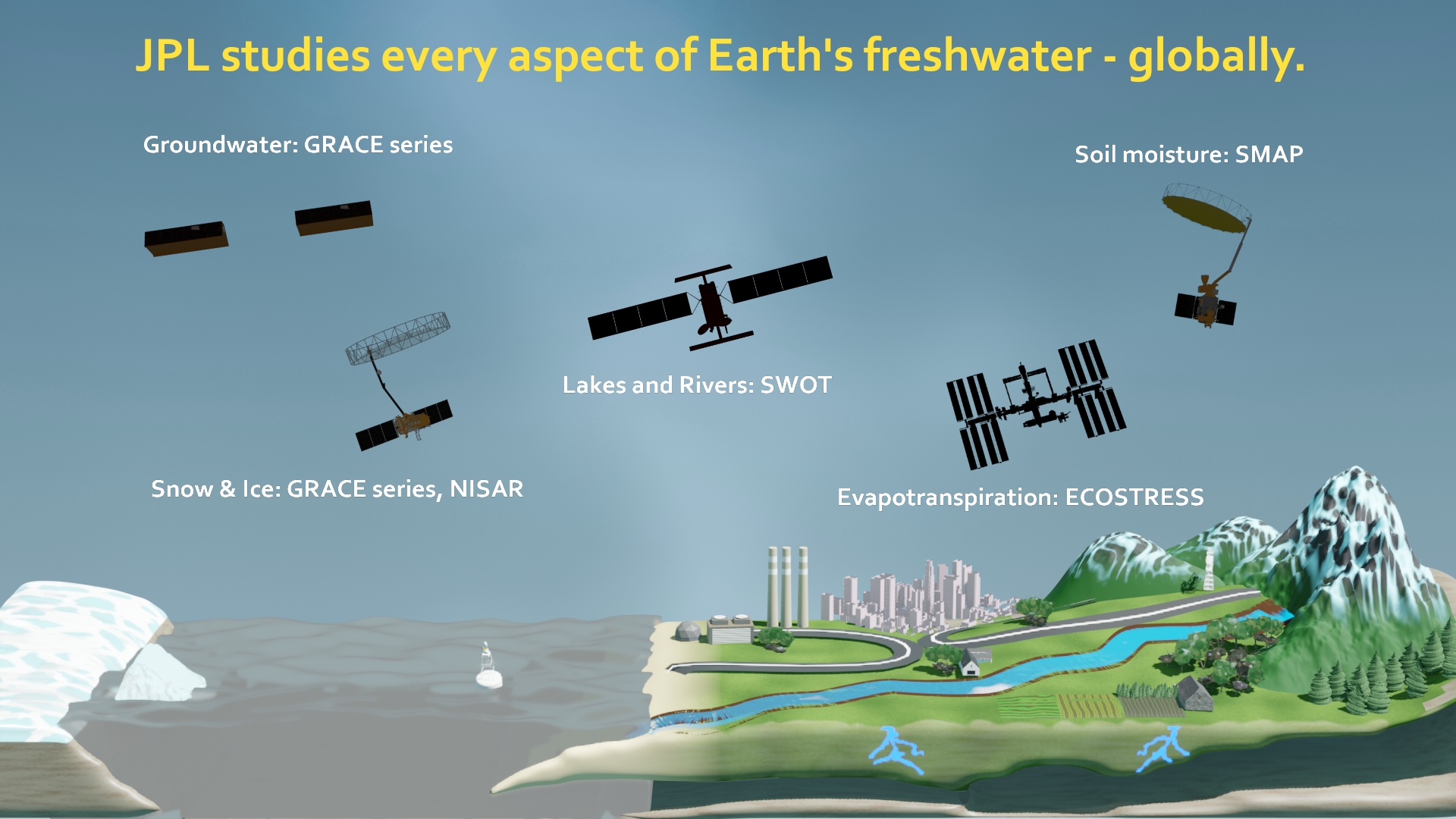
JPL has built more spaceborne technology for understanding water than any other institution on Earth. And it’s global.
No single form of water tells the whole story. That’s why JPL’s freshwater missions specialize across the full cycle – from the sky to the soil, snowfields to underground reservoirs. The data and insight we gather are what decision-makers use to keep people and ecosystems healthy.

JPL develops top-notch technology that allows us to specialize each satellite and instrument for the different hiding spots where water can be found.
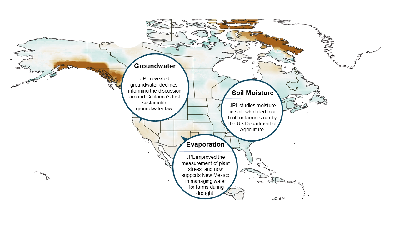
We partner with water resource agencies to make sure the wealth of information gathered by our satellites and models is put in the right hands.
What our partners are saying:
”Without NASA’s Earth observation missions ... water management agencies would lose a critical tool for managing New Mexico’s increasingly scarce water supplies. Our NASA-JPL-sponsored project will facilitate hydrologists’ and other water managers’ access to NASA datasets within the area of the Middle Rio Grande.”
"We have just completed the second quarter of a two-year project and already the work is bearing fruit .... I’d like to add that NASA and the folks at the Western Water Applications Offices and JPL have been a pleasure to work with.”
We are eager for more partners to use our data!
Feel free to reach out via our contact page.
Read more:
-
The Bangladesh government uses JPL satellite data from Jason-3 and SWOT in order to manage their freshwater supply and predict droughts and floods. The partnership was set up by Faisal Hossain, a professor at the University of Washington.
-
Rain in places like Vietnam and Thailand is becoming more and more unreliable, making life harder for farmers. To help out, JPL helped create a satellite-based modeling tool to predict farm harvest amounts months in advance.
-
Drought affects farmers in the US, and the drier the soil, the harder it is to grow crops. JPL’s SMAP satellite measures how dry the soil is, and is supporting a tool used by the US Department of Agriculture.